Archive | Uncategorized

Warragamba Dam wall

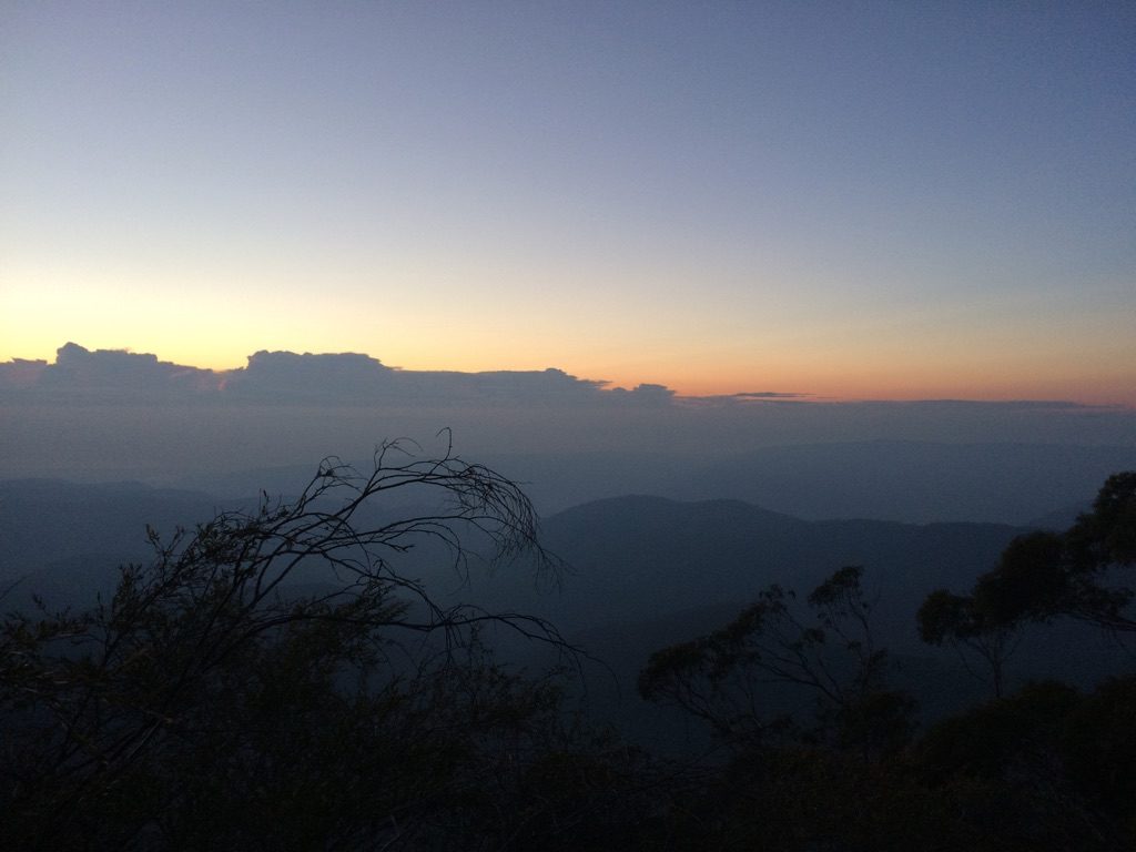
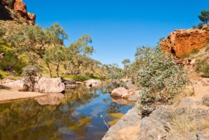
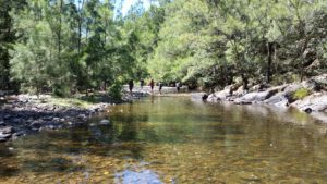
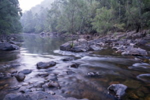
If the Warragamba Dam wall is raised by 14 metres, the dam will hold over two additional Sydney Harbours, 4,700 hectares of World Heritage listed National Parks, 1,800 hectares of declared Wilderness Areas and 65 kilometres of Blue Mountains’ wild rivers would be inundated and destroyed.

It is arguably the most protected natural landscape in Australia. The Coxs, Kowmung, Kedumba, Natti, Wollondilly and Little Rivers would be flooded for months at a time.

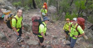
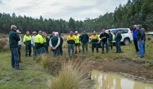
Many of our Club members throughout NSW visit these areas.

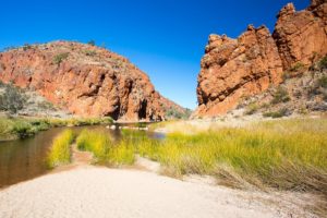
Without our support, internationally significant environments that are recognised in the Blue Mountains World Heritage listing would die from sedimentation, erosion and invasion of exotic plants.

There are 48 threatened plant and animal species which inhabit the proposed inundation area.

Species such as the vulnerable Camden White Gum and the Kowmung Hakea are predominantly found within the inundation area, with the dam raising likely pushing many species close to extinction.


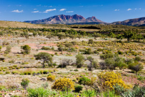
The area of proposed inundation is home to hundreds of Indigenous heritage sites.

Delicate rock art and marker sites will be forever destroyed if they are flooded by the raised dam for any length of time.

“Our history and our stories are in the landscape that surrounds Lake Burragorang. When Warragamba Dam flooded the valley in 1960, our lands and cultural sites were flooded. We do not want to see this story repeated with the remaining sites. Each time we lose a site, we lose part of our identity.”

– Kazan Brown

Gundungurra traditional owner and Warragamba resident


Information and photos courtesy of the Colong Foundation for Wilderness.

For more information, visit their website.

BUSH SEARCH AND RESCUE NSW TO JOIN NSW STATE EMERGENCY SERVICE

Bush Search and Rescue NSW​ have today announced that they have joined the NSW State

Emergency Service as the NSW SES Bush Search and Rescue Unit​ (NSW SES BSAR).

The move is an exciting development in the history of BSAR NSW, the oldest volunteer land

search unit in Australia, and will build on the existing land search capability within the SES.


With a focus on remote area searches, conducted in rough and challenging terrain, over 100

members of Bush Search and Rescue NSW will bring their knowledge and experience of working

in wilderness areas to the NSW SES. With expertise in bush navigation, search techniques,

canyon and vertical searching, BSAR will form an integral part of the SES’ response to land search

operations across the state.


President of Bush Search and Rescue NSW, Keith Maxwell says,

“Since 1936, BSAR has brought together experienced and skilled bushwalkers, many with valuable

local knowledge of wilderness areas, to assist the NSW Police and other agencies in searching for

missing people and aircraft. Our move to work as a unit within the NSW SES, will only go to

strengthen the existing relationships we have with the SES and help provide the best possible land

search and rescue capability to the people of NSW.”


The move comes at a time when the NSW SES is undergoing significant change to its structures

and organisation. These changes, spearheaded by their ‘Volunteering Reimagined’ initiative,

opens up new ways of building capability and capacity, within a new and flexible model of

volunteering.


“I am proud and honoured to welcome the Bush Search and Rescue into the NSW SES. The

BSAR volunteers will greatly enhance our Service’s remote search capability, bringing a wealth of

specialised experience with an excellent reputation. They are now very much a part of our NSW

SES family, and I look forward to them supporting search operations across the state.” Mark

Smethurst, NSW SES Commissioner.


NSW SES BSAR will operate as a unit within the SES and continue to be available to respond to

remote area land searches 24/7, as they have done under the umbrella of the Volunteer Rescue

Association (VRA), since 1970.


As hosts of the annual NavShield​ event (Australian Emergency Services Wilderness Navigation

Shield), BSAR are looking forward to the event sitting within the SES and continuing to grow the

training, development and team building opportunities that this premier navigation event offers.

For media enquiries, please contact: publicity@bsar.org.au | 0412 304 071 or

secretary@bsar.org.au

Photo courtesy of Caro Ryan


Splendour Rock 2018 – 70 years

Bushwalking NSW President, Alex Allchin, reading the program

This year there was a strong crowd of mid-week walkers present on ANZAC Day to remember the dedication of the Splendour Rock plaque 70 years ago in 1948. Background notes were read out about installing the plaque before the usual simple but of course moving ceremony. The service is roughly timed to have a spectacular climax with sunrise and cloud this year gave us a special sunrise over Kings Tableland.

The author and Bushwalking NSW President (in hat) Alex Allchin both assisted in this ceremony which opened to a welcome to country and concluded with the National Anthem. A bugler played ‘The Last Post’.

Splendour Rock is an outstanding vantage point with around a 220 degree sweep of view that goes well into the distance. It is also hard to tire of the “Wild Dogs” access walk with its mix of forest and rock pass / ups and downs. Overnight near Splendour Rock a little tent village pops up. There is a certain magic in an ANZAC Day visit to Splendour Rock. 2019 could be a good year to sense the magic of this place. Put the date in your diary now.

Keith Maxwell.

Splendour Rock 2018 sunrise

Myrtle Rust

Myrtle Rust is a member of the guava rust complex caused by Puccinia psidii, a known significant pathogen of Myrtaceae plants outside Australia, and was first detected on the Central Coast of NSW in 2010.

It has now firmly established itself along the east coast of Australia from southern New South Wales to far north Queensland, and in some parts of Victoria. Its spores spread rapidly and by air, making whole eradication unfeasible.  However, areas such as Wambina Nature Reserve have eradication plans and are quarantined.

Tasmania’s efforts to educate bushwalkers included a Myrtle Rust ID card.

Studies have found that at least 347 Australian Myrtaceae species are susceptible.

The most notably affected are eucalypts (Eucalyptus, Angophora and Corymbia), paperbarks and bottlebrushes (Melaleuca and, formerly, Callistemon), and tea-trees (Leptospermum).

Myrtle Rust attacks young, soft, actively growing leaves, shoot tips and young stems, as well as fruits and flower parts of susceptible plants.

The first signs of myrtle rust infection are tiny raised spots that are brown to grey, often with red-purple haloes.

After infection, the spots produce masses of distinctive yellow spores.

The fungus is spread very easily by these spores through the air and water, and can also accumulate on clothing, gloves, hats, tents, watches, wristbands and other gear.

Bushland that we visit could be infected with Myrtle Rust. Remember to arrive clean and leave clean, pack light, carpool when possible and leave cars in carpark areas or away from bush.

If there is any chance that you have encountered the fungus, change into fresh clothes and wash your hands, face and footwear to prevent it spreading. Clean your shoes with a 70% methylated spirits or benzyl alkonium chloride disinfectant.

Standard washing-machine use with detergent will kill Myrtle Rust spores on clothing, gloves, hats and other items suitable for the washing machine. Brush up on how to Clean Your Gear and see our Solutions page for information.


Notes:

https://www.invasives.org.au/project/myrtle-rust

https://www.dpi.nsw.gov.au/biosecurity/plant/established-plant-pests-and-diseases/myrtle-rust

http://www.environment.nsw.gov.au/resources/pestsweeds/110683myrtlerustmp.pdf

http://dpipwe.tas.gov.au/Documents/myrtle.pdf

https://invasives.org.au/wp-content/uploads/2017/11/Case-Study-Myrtle-rust.pdf

https://invasives.org.au/wp-content/uploads/2014/02/fs_myrtle_rust.pdf

Update:

https://www.abc.net.au/news/science/2019-12-04/myrtle-rust-fungus-invasive-species-killing-native-trees/11730738

Bushwalkers & Rogainers 30th Annual NavShield

Press Release to Bushwalkers & Rogainers

30th Annual NavShield

23 & 24 June 2018

Great Navigation Training Opportunity!

Please add to your winter activities program

The NSW Emergency Services Wilderness Navigation Shield (NavShield), is a rogain event where teams
attempt to gain as many points as possible by finding their way on foot, through unfamiliar wilderness terrain
to pre-marked checkpoints.

The course covers an area of approximately 80 square kilometres with only traditional map and compass
navigation techniques permitted. There are both day and overnight event options.
The course is set by a team of skilled navigators from Bush Search and Rescue NSW (the oldest land
search and rescue unit in Australia) – the official Search & Rescue arm of Bushwalking NSW.

The course is set in a secret location (approx 2.5 hrs from Sydney) and will take place on the last weekend
of June 2018.

Encompassing the finest traditions and character of off-track bushwalking, NavShield is an opportunity to
get back to basics and work on important navigation skills, without the use of GPS technology.
It’s an ideal training opportunity for your club members to learn and practice on a fun and enjoyable
weekend. You can choose to make it as competitive or as amateur/fun as you like!

We ask all bushwalking clubs to please add this great event to their calendars and encourage teams to take
part.

With a successful 30 year history, we want to make this year’s event one to celebrate and are planning for it
to be a standout event. If you or your club has ever considered taking part, or perhaps attended past events,
we invite you to make a commitment to be a part of this 30th year celebration event.

To celebrate and thanks to the generous support of our friends in SES and RFS, we’ve reduced the entry
fee to only $40 per person. All the more reason to get involved!

Past events have seen entries from a variety of Bushwalking Clubs and Rogainers, Police, Ambulance, Rural
Fire Service, State Emergency Service, Volunteer Rescue Association and the Armed Forces.

Now is the time to organise and motivate your club to take part in this great event!

Registrations open 2 April.

For all details and registration, visit Bush Search and Rescue NSW.

Splendour Rock 70 anniversary

Wednesday 25 April 2018

This will be a special day as it will be 70 years since the bushwalkers who had survived WWII gathered to remember their lost walking mates.  They dedicated a permanent memorial to them with the outstanding sentence “THEIR SPLENDOUR SHALL NEVER FADE”

A simple ceremony will be held in the half-light before sunrise over Kings Table Land and a cloud covered Lake Burragorang.  There is a special atmosphere in the overnight (dry; no water) camp of the 24th on Mt Dingo.

All bushwalkers should visit Splendour Rock at least once since it holds so many bushwalking memories.  The vista more than lives up to its ‘splendour’ name as you see a vast sweep of bushwalking country.  In 1948 the bushwalkers could still remember friends who had pioneered ways to visit so much of this country in overnight trips.

GETTING THERE

Splendour Rock is on the far end Mt Dingo in the Megalong Valley.  It is hard to tire of walking the Wild Dogs with its mix of place names and bushwalking challenges over and around Mt Mouin, Mt Warrigal, Merrimerrigal before finally Mt Dingo.

Bushwalking NSW will be supporting this anniversary.  In 1958 they started a new visitors’ logbook with a special title page.

The BNSW website has more information on these men from a range of clubs (some of which are no more).  See www.bushwalkingnsw.org.au

Now is the time to start planning your 2018 ANZAC Day trip to this place of so much special importance to bushwalking.


Club committee tools and tips

Running a successful club takes a few tools and skills that can be just as handy as a map and compass for keeping your club on track!

Great bushwalkers use their tools and resources exceptionally efficiently, so on this page we shares some tools and tips from Bushwalking NSW and our clubs. This is by no means all the great tips and tools employed by all our clubs, so if you’d like to add to this list, please share your tips here.


Phytophthora Cinnamomi

Phytophthora Cinnamomi is a fungus that grows inside a susceptible plant’s roots, reducing its ability to transport nutrients to the rest of the tree, killing it or making the tree look sickly (generally known as Dieback).

Trees and plants infect each other by root-to-root contact. However, on a downward slope Phytopthora can travel up to 40 metres per year through soil and mud, and can lay dormant in dry soil.

Some examples of NSW affected areas are Wollemi National Park, Barrington Tops National Park and Mount Imlay National Park where flora and fauna have been radically changed by it. The flora suffering Dieback are quarantined to limit the spread. The infected flora are still important, providing a habitat for species and preventing salinity and erosion in the area.


As bushwalkers, we can play our part when walking nearby infected areas, by assisting in keeping other areas free of infection, limiting the spread and reducing our impact. It’s Sweet to Walk Soft!

Unlike diseases such as Myrtle Rust, studies have found that contaminated trees do not contain the fungus on leaves or branches, but the fungus can still be transported by touching infected roots, water, soil or mud.


Read all signage in our National Parks and follow their instructions, staying out of quarantined areas, as well as using Hygiene Stations when available to brush down gear. Unless with an experienced leader with background training and knowledge in the area, we must stick to tracks and paths while bushwalking and/or driving, and limit the amount of vehicles we take.


To learn more about responsibility in the bush, join your local bushwalking Club, take one of our FREE courses or try volunteering to protect our lovely National Parks.


Notes:

http://www.environment.nsw.gov.au/determinations/PhytophthoraKTPListing.htm

http://www.environment.nsw.gov.au/threatenedspeciesapp/profile.aspx?id=20026

http://www.cpsm-phytophthora.org/

https://www.dwg.org.au/

http://barmac.com.au/problem/phytophthora-cinnamomi/

Larapinta Trek 2018

Trekking the incredible Larapinta Trail is an adventure on many people’s bucket lists.

Simpsons Gap, Northen Territory, Australia


Standing on ancient escarpments and gazing out upon the ochre-coloured landscapes of Central Australia, following Aboriginal Dreaming tracks and trekking beside one of the world’s oldest river systems is surely an adventure of a lifetime.

Our friends at Melanoma Institute Australia would like to invite you on their Outback Trek adventure in September 2018.

Not only will you experience a trek along one of Australia’s premier walking tracks, but you will be supporting life-saving research at Melanoma Institute Australia.


A view of Glen Helen Gorge on a clear winter’s day in Northern Territory, Australia


Australia has one of the highest rates of melanoma in the world. The good news is that 90% of melanomas can be successfully treated if detected early.

However, in the other 10% of cases, life-threatening spread will have already occurred.

More than 1,800 Australians will die from melanoma this year alone and it kills more young Australians (20-39 year olds) than any other single cancer.

Research at Melanoma Institute Australia has made significant progress in developing life-saving treatments, but support is still needed as there is still no cure. No-one should die from melanoma, and you can help make a difference while doing something that you love.


Mt. Sonder, West MacDonnell National Park, Northern Territory, Australia


By taking part in this unique adventure you’ll pave the way for new research to improve melanoma treatment, and ultimately find a cure.

Visit melanoma.org.au to find out more.

David’s Lane Cove River Minimal Impact Training walks

David will be leading two Minimal Impact Bushwalking Awareness Walks in Lane Cove National Park and this webpage shows the planned route. To book for these walks go to: Bushwalking NSW Minimal Impact Bushwalking Training Events

The walk will start at the Koonjerie Picnic Area in the Lane Cove National Park:

The walk will parts of the Great North Walk on the east side of the river after crossing at the Lane Cove Weir:

The walk goes back across the river near Christie Park where the river is not very wide or deep, and there are many rocks creating the crossing:

The walk will finish at the Macquarie Centre:

From here a 545 bus can be caught back to the starting point or Chatswood Station.